Yosemite - Half Dome
Summit Elevation: 8800'
Trail distance: ~17+ round trip (varies by where you park, shuttle bus ect.)
elevation gain: 4800'
I took my first trip to Yosemite two weekends ago to hike the legendary Half Dome summit trail. I’ve heard this referred to as one of the best day hikes in the country. I don’t think I’d go as far as calling it that, but it does contain two features that like to see in a great hard hike; height and distance. Being at least 8 miles each way, with a total elevation gain of 4800’, the trail was somewhat of a challenge and a lot of fun. The feature that makes this trek most noteworthy; however; is the very last section of the trail that involves using ¾ in steel cables to haul yourself up a 49 degree incline.

Classic view of Half Dome where you can see the 4000ft cliff face formed when half of the mountain fell off thousands of years ago. This sight can only be seen by climbing up a a trail on the opposite side of valley from where we were, so I had to steal this pic from another website: http://www.raingod.com/angus/Gallery/Photos/NorthAmerica/USA/California/YosemiteHalfDome.html
We left Friday evening so we could get on the trail earlier in the morning, and also to cut down on Saturday drive time, since it’s a 3+ hour drive each way. This also meant that we arrived late enough that the park gates were left unattended, saving us the $20 entrance fee. As expected, the camp sites were full, so we grabbed our gear and hiked down a trail, that according to my map, went passed park boundaries and back into the National Forest. (This is important because you can generally camp anywhere you want in a National Forest , but rangers frown up, to say the least, people disperse camping inside the National Parks.)


(1)Camp in the forest (2)Javier walking down the road to the trailhead (3)Stream (duh)
We got on the Half Dome trail later than I had hoped the next morning, hitting the trail head some time after 9:00. This meant was that we’d have to deal with a lot more people. Hundreds and hundreds of people hike the trail on a daily basis.
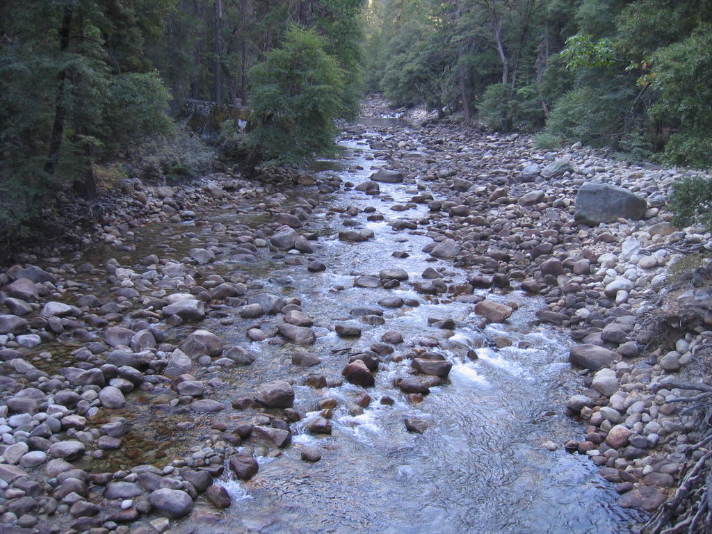
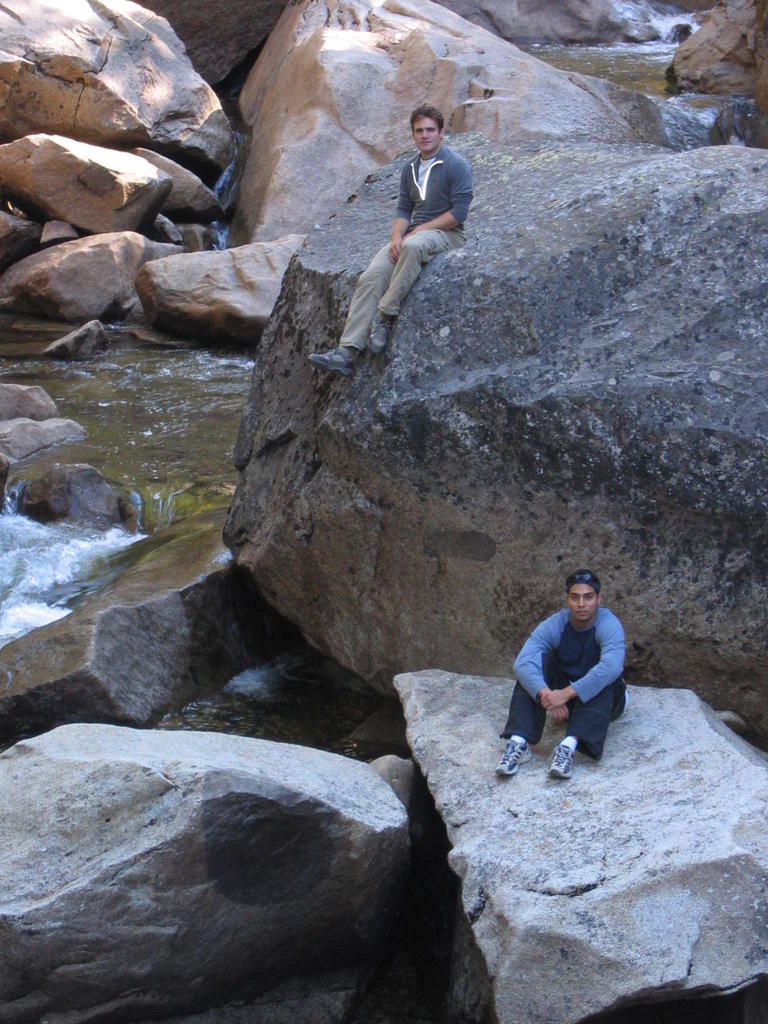
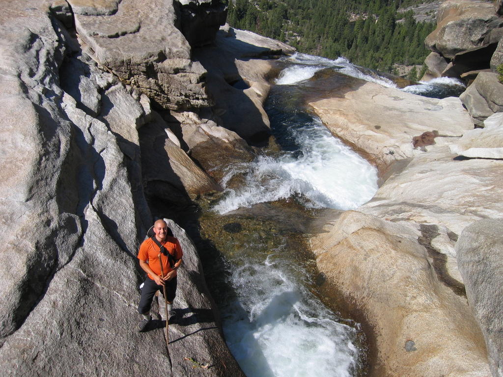
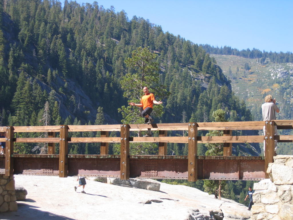
The hike started with a very gradual incline, shortly leading us to a bridge with a nice picture opportunity.

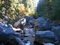

(1) Javier on the bridge - Yes, there were three of us on the trip, two were named javier. (2) Rocks in the water (3) Javier and I on the rocks. Ok, I guess these pictures don't need much description
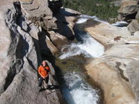
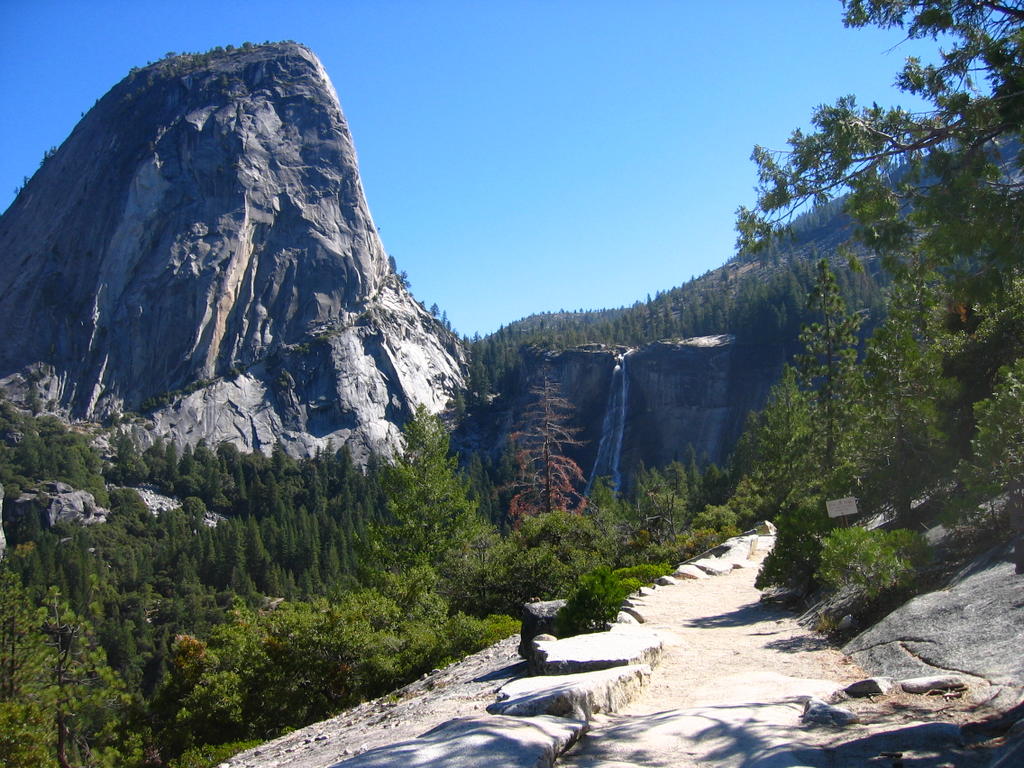
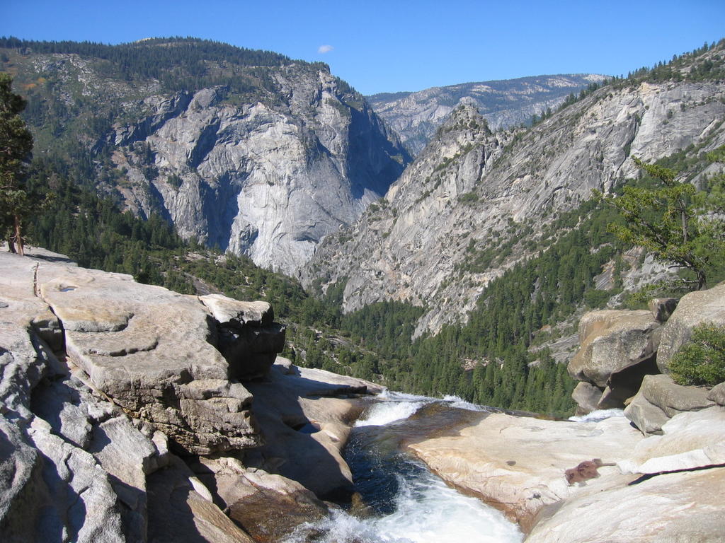
From there, the trail started the moderate switchbacks leading up the valley. A few miles later we hit a fork in the trail, where you have the option of either heading down to go past Nevada falls (which would then entail needing to climb up again), or to continue up, and cross over the source of the falls. We chose the recommended route that continued up. This part of the trail is known as “Mist Trail”, because the cliff above you is part of the watershed area that creates the falls. We were there during the dry part of the season though, so despite there being some dripping water, the trail was relatively dry compared to what it can be.


Nevada Falls and the Mist Trail
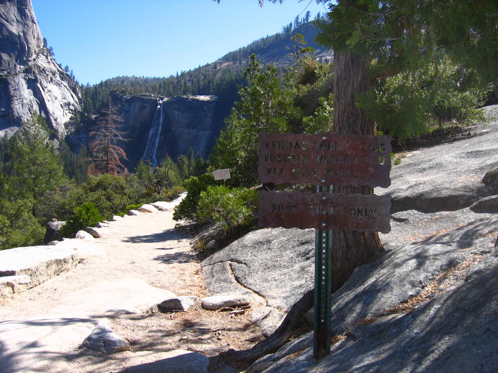
Shortly afterwards we came to the bridge that crossed over the stream pouring over the mountain to form Nevada Falls. I was rather impressed with the overall setup. You could tell that the entire area was maintained rather regularly, and designed to accommodate a large number of people, of which there were a lot of hanging about. Despite this, though, the park had managed keep the area looking very natural, and any improvements made by them were very unobtrusive to the surroundings.


Top of Nevada Falls
After leaving the crossing, the switchbacks picked up a little more pitch, which lead to requests from the others to take breaks. Apparently some people like to breaks while hiking; who would have guessed. This eventually led to us taking a lunch break, which was understandable since it was already well past noon. The extra calories from lunch gave me a big sugar push, and I ran the final mile or so up the regular part of the trail, leaving the valley, and hitting the actual dome of the mountain. This gave a good twenty minutes or so to wait up for the others. While I was waiting, I saw two teenage girls come down the mountain from the dome. As they started down the trail, one of them actually whipped out an old style compact, and started reapplying base to her face. Unfortunately, I couldn’t get the camera out in time.


Approaching the dome, and starting up it
The first part of the last part of the trail consists of very steep switch backs which could best be described as stairs carved, jack hammered, and built into the mountain side. At some points, you are actually just walking up a rather smooth slope of granite. I was rather impressed by older people who were tackling this task. Then, we came to the infamous cables.


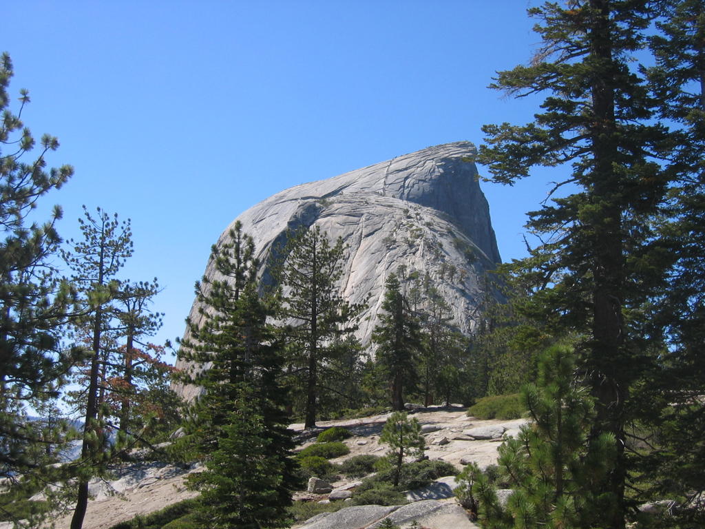
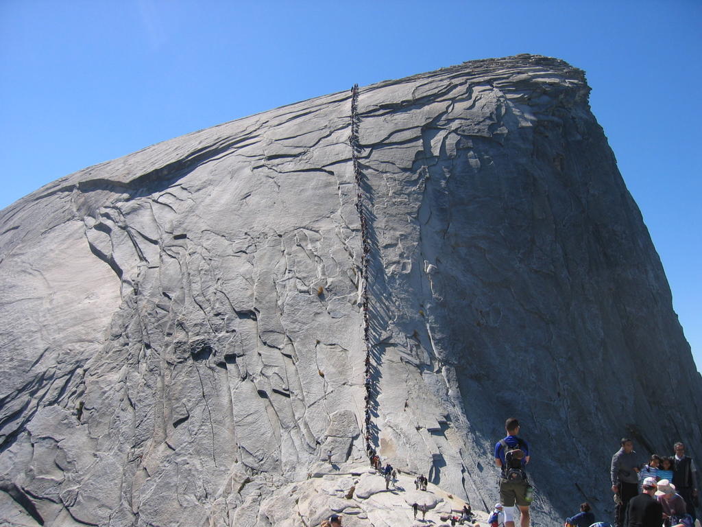
The upper dome, and the infamous cables
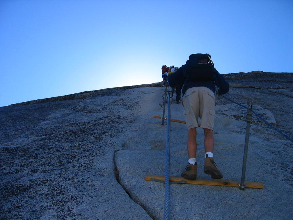
The cables were much steeper than I expected. I’m used to popular trails like this being built to accommodate the lowest common denominator. I figured there’d be all sorts of warnings, but when I’d get there, the slope would be shallow enough to walk up if you were competent, and that the cables would be there just for assistance. Uh uh. There were two cables, set up about 3 feet apart, held up by poles drilled into the rock. This formed a channel to walk up, with a hand on each cable. Every ten feet or so, a wooden two by for was fixed to the ground, to allow something firm to place your feet on. The problem, though, is that there are people trying to go down, and up at the same time, which drastically slows down the climbing process. As a result, the line was moving pretty slow. (Yeah, there’s a line) We followed the handful of people who were going up the outside of the cables ladder, instead of the inside. This allowed us to pass everyone stuck in the line. This was a lot more dangerous, though. If you’d slip, and loose your grip on the cable, you’d most like tumble down the dome, and off the side, which would be 4000’ drop.

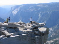

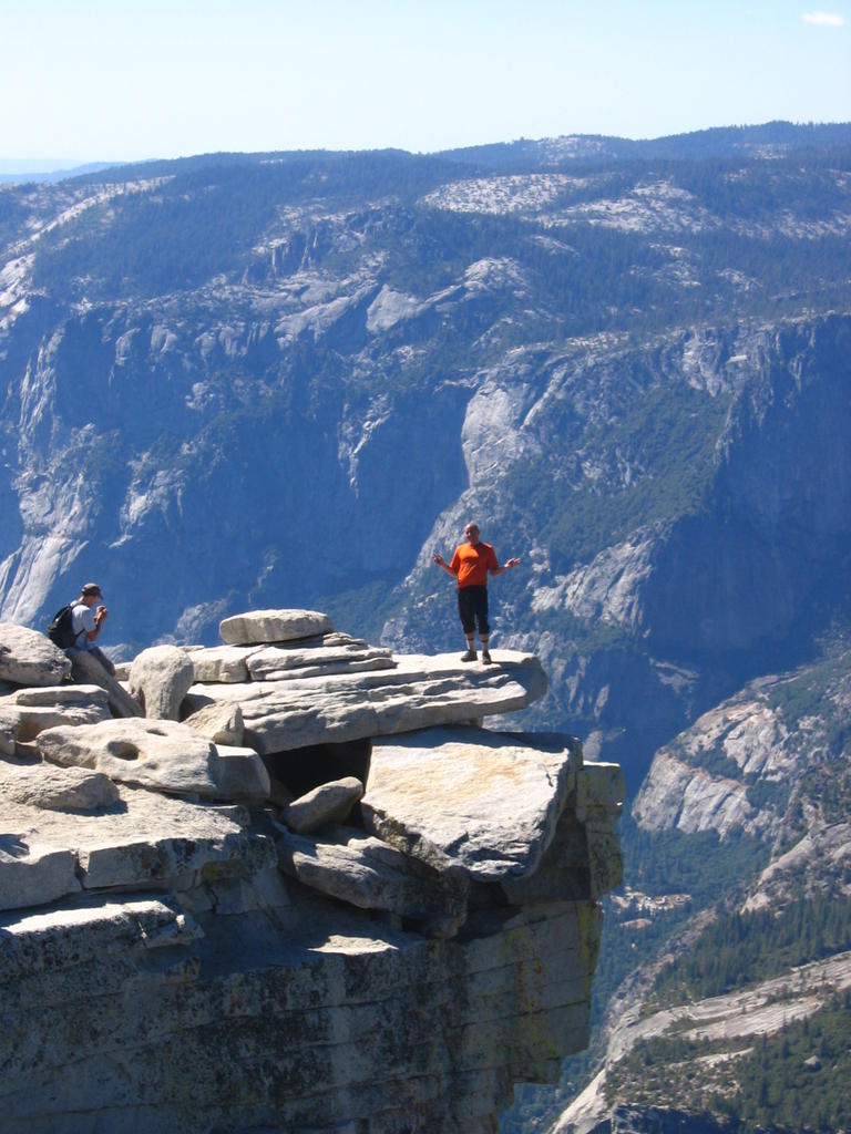
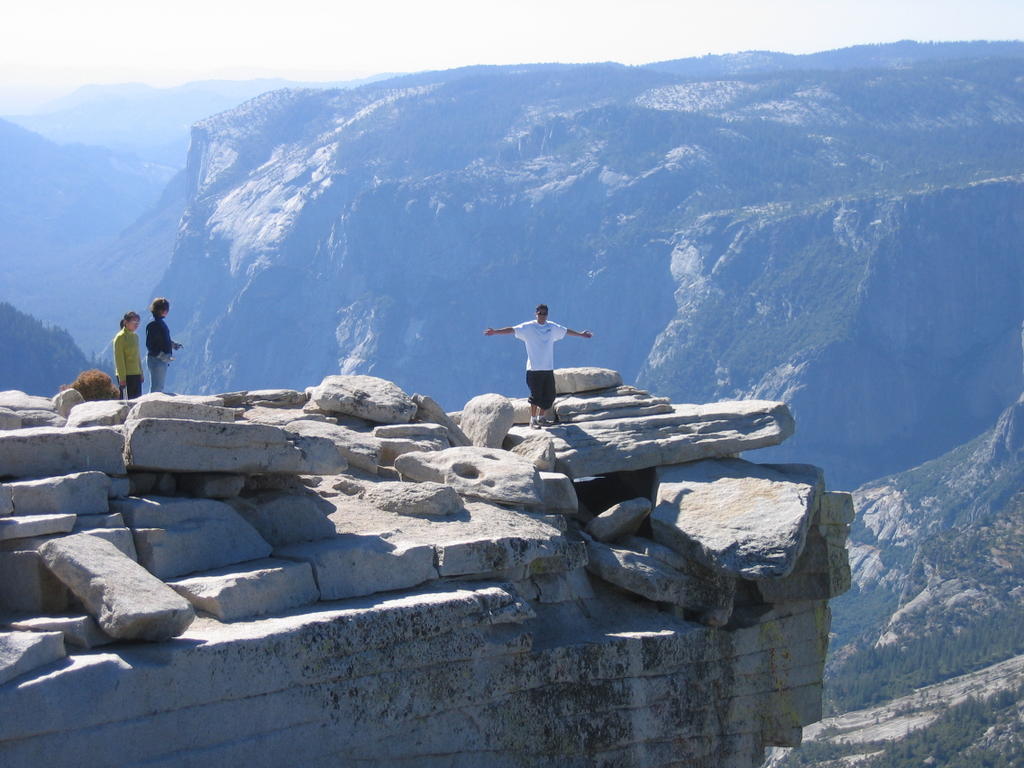
"The diving board" as it is called, protrudes over the edge. There were so many people, you had to stand in line to get your picture on it

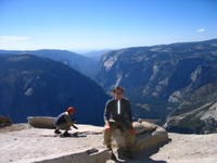

On the summit
After hanging out on top for a while, we took some pictures, and headed down, just making it before dark. We stopped in “””” for really good pizza on the way back, and made it back to Sacramento around midnight.


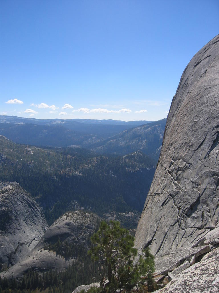
Views of Yosemite Valley from the summit of Half Dome
Quote of the trip:
(And this was said in all honesty during a conversation.)
Javier Pasillas: “What’s that called, those things that people have?
Derek: “Ethics?”
Javier: “Yeah, that’s it. Ethics.”
Trail distance: ~17+ round trip (varies by where you park, shuttle bus ect.)
elevation gain: 4800'
I took my first trip to Yosemite two weekends ago to hike the legendary Half Dome summit trail. I’ve heard this referred to as one of the best day hikes in the country. I don’t think I’d go as far as calling it that, but it does contain two features that like to see in a great hard hike; height and distance. Being at least 8 miles each way, with a total elevation gain of 4800’, the trail was somewhat of a challenge and a lot of fun. The feature that makes this trek most noteworthy; however; is the very last section of the trail that involves using ¾ in steel cables to haul yourself up a 49 degree incline.
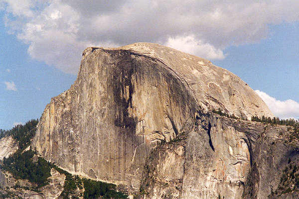
Classic view of Half Dome where you can see the 4000ft cliff face formed when half of the mountain fell off thousands of years ago. This sight can only be seen by climbing up a a trail on the opposite side of valley from where we were, so I had to steal this pic from another website: http://www.raingod.com/angus/Gallery/Photos/NorthAmerica/USA/California/YosemiteHalfDome.html
We left Friday evening so we could get on the trail earlier in the morning, and also to cut down on Saturday drive time, since it’s a 3+ hour drive each way. This also meant that we arrived late enough that the park gates were left unattended, saving us the $20 entrance fee. As expected, the camp sites were full, so we grabbed our gear and hiked down a trail, that according to my map, went passed park boundaries and back into the National Forest. (This is important because you can generally camp anywhere you want in a National Forest , but rangers frown up, to say the least, people disperse camping inside the National Parks.)
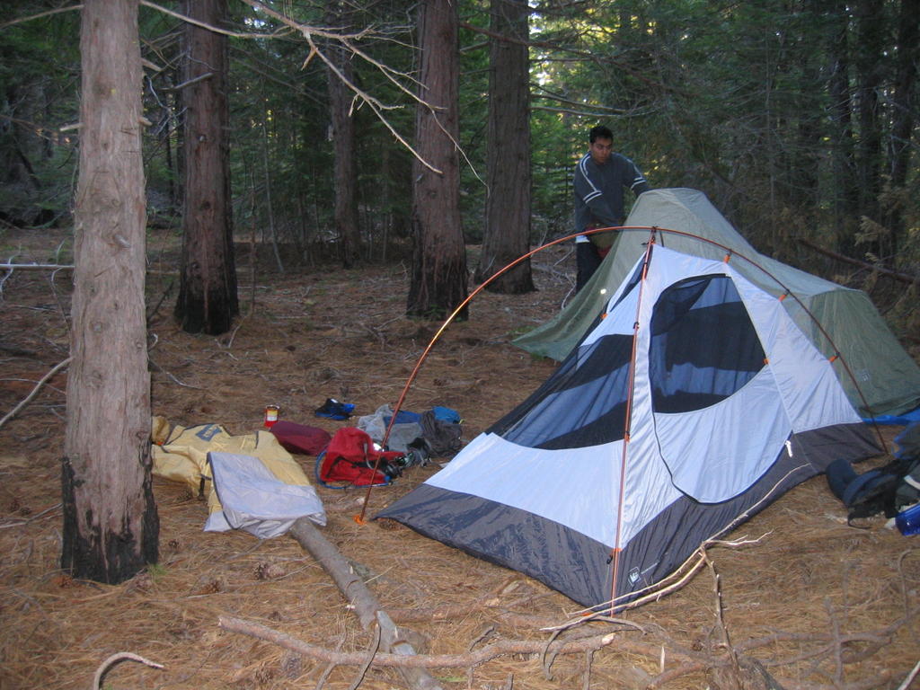
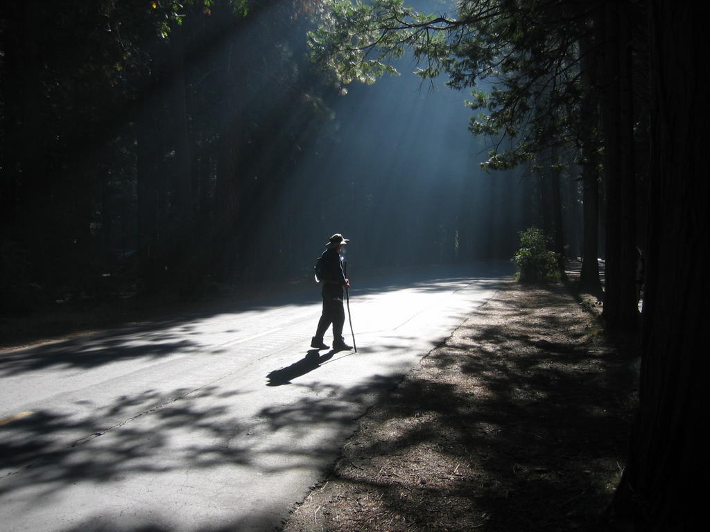
(1)Camp in the forest (2)Javier walking down the road to the trailhead (3)Stream (duh)
We got on the Half Dome trail later than I had hoped the next morning, hitting the trail head some time after 9:00. This meant was that we’d have to deal with a lot more people. Hundreds and hundreds of people hike the trail on a daily basis.
The hike started with a very gradual incline, shortly leading us to a bridge with a nice picture opportunity.


(1) Javier on the bridge - Yes, there were three of us on the trip, two were named javier. (2) Rocks in the water (3) Javier and I on the rocks. Ok, I guess these pictures don't need much description
From there, the trail started the moderate switchbacks leading up the valley. A few miles later we hit a fork in the trail, where you have the option of either heading down to go past Nevada falls (which would then entail needing to climb up again), or to continue up, and cross over the source of the falls. We chose the recommended route that continued up. This part of the trail is known as “Mist Trail”, because the cliff above you is part of the watershed area that creates the falls. We were there during the dry part of the season though, so despite there being some dripping water, the trail was relatively dry compared to what it can be.
Nevada Falls and the Mist Trail
Shortly afterwards we came to the bridge that crossed over the stream pouring over the mountain to form Nevada Falls. I was rather impressed with the overall setup. You could tell that the entire area was maintained rather regularly, and designed to accommodate a large number of people, of which there were a lot of hanging about. Despite this, though, the park had managed keep the area looking very natural, and any improvements made by them were very unobtrusive to the surroundings.

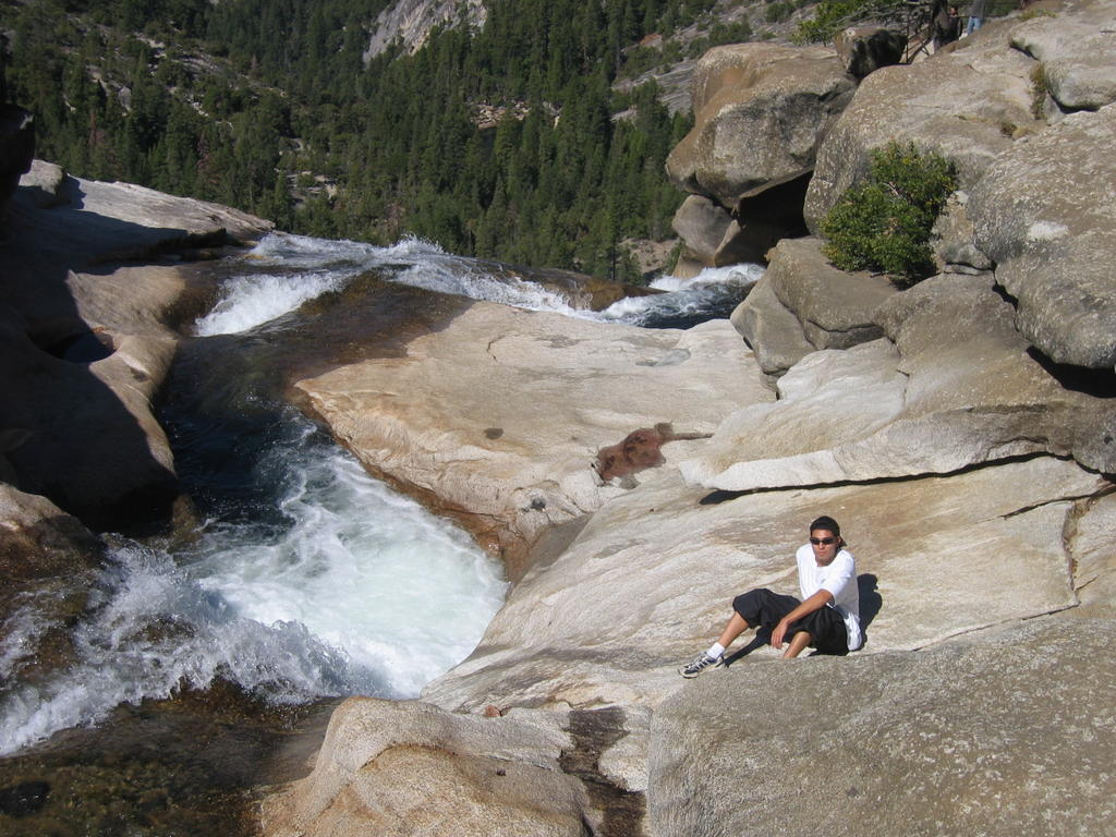
Top of Nevada Falls
After leaving the crossing, the switchbacks picked up a little more pitch, which lead to requests from the others to take breaks. Apparently some people like to breaks while hiking; who would have guessed. This eventually led to us taking a lunch break, which was understandable since it was already well past noon. The extra calories from lunch gave me a big sugar push, and I ran the final mile or so up the regular part of the trail, leaving the valley, and hitting the actual dome of the mountain. This gave a good twenty minutes or so to wait up for the others. While I was waiting, I saw two teenage girls come down the mountain from the dome. As they started down the trail, one of them actually whipped out an old style compact, and started reapplying base to her face. Unfortunately, I couldn’t get the camera out in time.
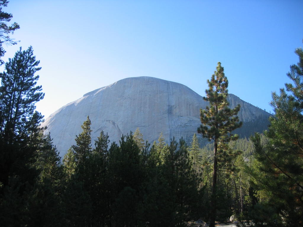

Approaching the dome, and starting up it
The first part of the last part of the trail consists of very steep switch backs which could best be described as stairs carved, jack hammered, and built into the mountain side. At some points, you are actually just walking up a rather smooth slope of granite. I was rather impressed by older people who were tackling this task. Then, we came to the infamous cables.
The upper dome, and the infamous cables
The cables were much steeper than I expected. I’m used to popular trails like this being built to accommodate the lowest common denominator. I figured there’d be all sorts of warnings, but when I’d get there, the slope would be shallow enough to walk up if you were competent, and that the cables would be there just for assistance. Uh uh. There were two cables, set up about 3 feet apart, held up by poles drilled into the rock. This formed a channel to walk up, with a hand on each cable. Every ten feet or so, a wooden two by for was fixed to the ground, to allow something firm to place your feet on. The problem, though, is that there are people trying to go down, and up at the same time, which drastically slows down the climbing process. As a result, the line was moving pretty slow. (Yeah, there’s a line) We followed the handful of people who were going up the outside of the cables ladder, instead of the inside. This allowed us to pass everyone stuck in the line. This was a lot more dangerous, though. If you’d slip, and loose your grip on the cable, you’d most like tumble down the dome, and off the side, which would be 4000’ drop.

"The diving board" as it is called, protrudes over the edge. There were so many people, you had to stand in line to get your picture on it
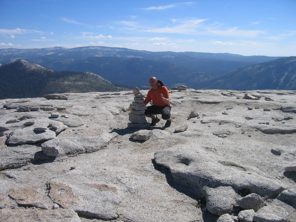

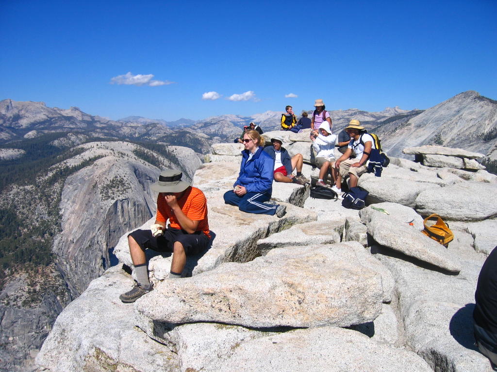
On the summit
After hanging out on top for a while, we took some pictures, and headed down, just making it before dark. We stopped in “””” for really good pizza on the way back, and made it back to Sacramento around midnight.
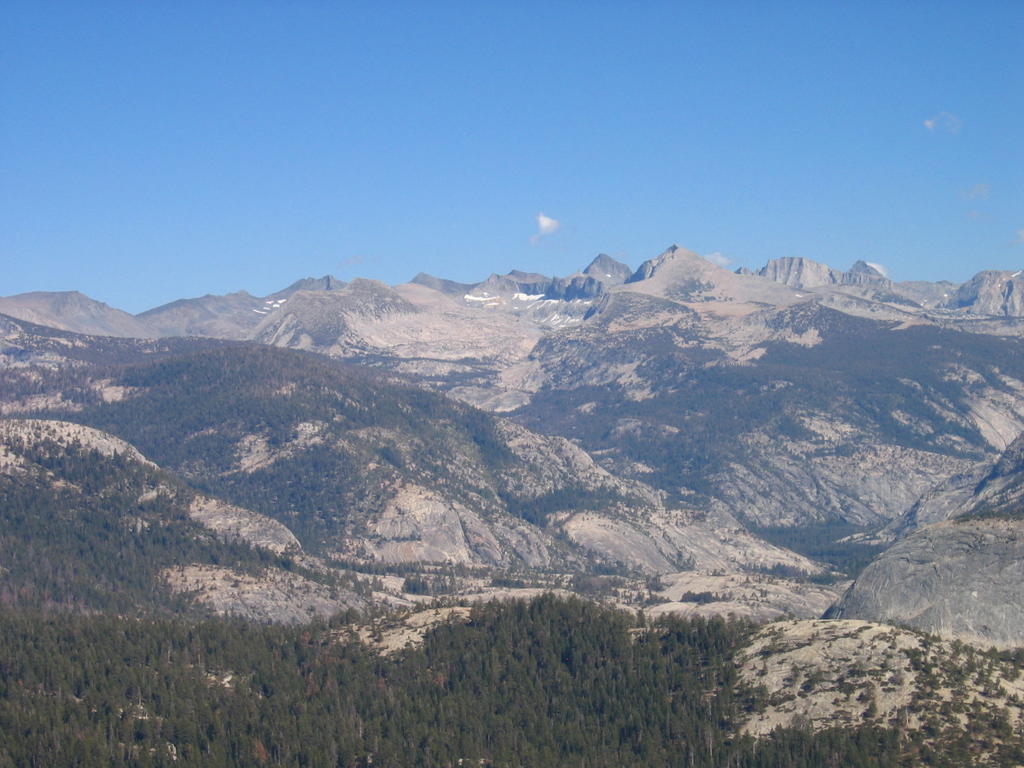

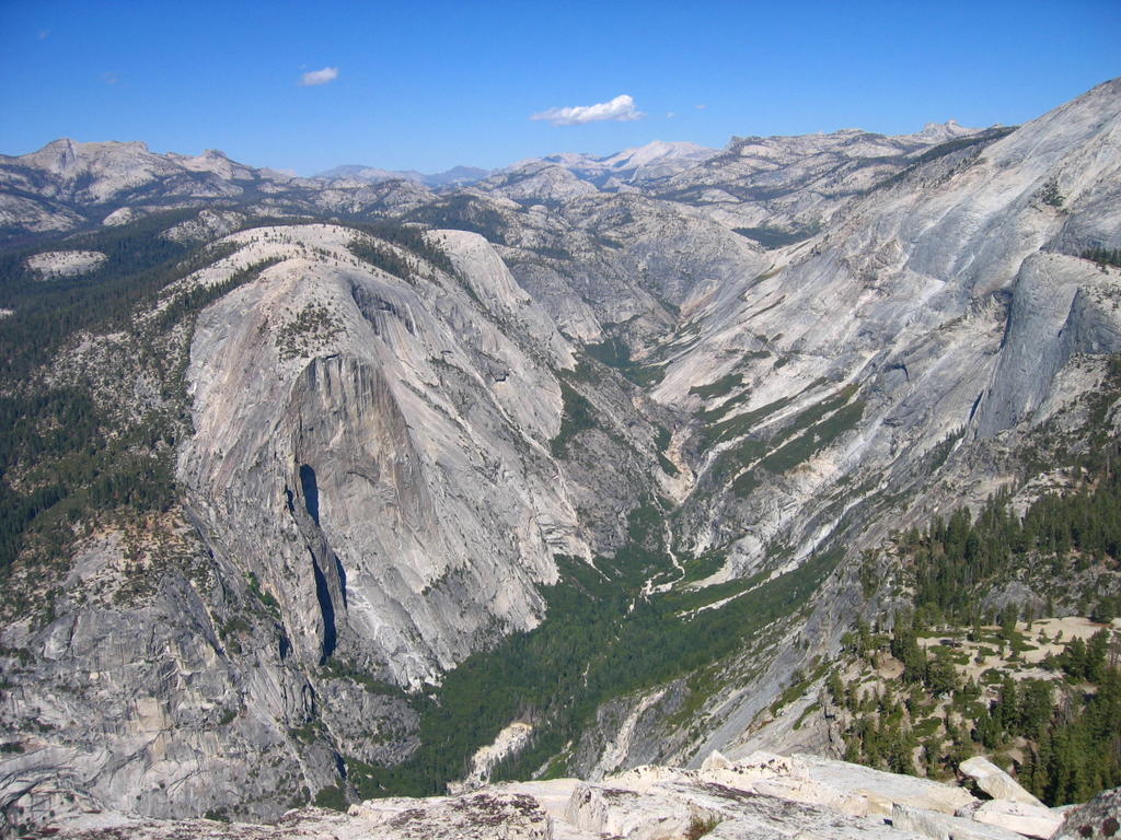
Views of Yosemite Valley from the summit of Half Dome
Quote of the trip:
(And this was said in all honesty during a conversation.)
Javier Pasillas: “What’s that called, those things that people have?
Derek: “Ethics?”
Javier: “Yeah, that’s it. Ethics.”
posted by Frick at 8:46 PM
![]()
![]()

0 Comments:
Post a Comment
<< Home