Friday, October 07, 2005

Lava Rock Rock Revolution

Although America is full of diversity, with people originating from different backgrounds, and being raised in various environments, many of us still share some common bonds. Apple pie, baseball (for better or worse), and of course, the lava game. Admit it. You all played the lava game when you were a kid; trying to jump from furniture to furniture in the living room with out touching the floor, pretending the carpet was actually lava that would incinerate your feet if touched, or consume your entire body if you were unfortunate enough to fall completely to the floor. In the really difficult spots, you might even throw a couch cushion onto the floor to act as a stepping stone. (Deep down, we knew this was cheating though. Even as a 4 yr old, we comprehended that a couch cushion obviously burns in lava, and the surface tension of the molten rock would not support our weight for very long.)

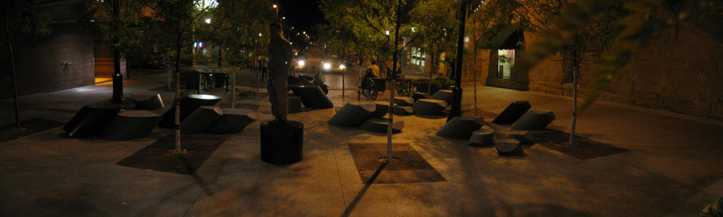
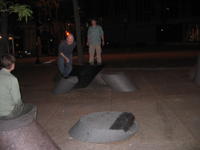
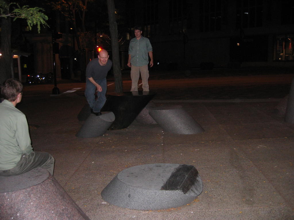
Why do I bring this up you ask? Well, while taking a stroll down State Street mall in Madison, WI this past weekend, my siblings ( JoJo and Equipoise) and I discovered that what first appeared to be a modern art/stone/seating arrangement, was actually a full sized outdoor lava game. Or, as I dubbed it, Lava Rock Rock Revolution. (A name derived from the popular arcade game, Dance Dance Revolution II)

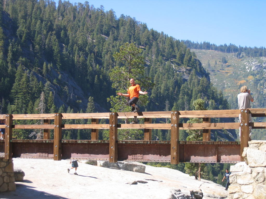
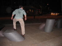
Hold onto your hats, the lava game isn’t just for kids anymore. Much more difficult than the kid’s version, and much more dangerous, Lava Rock Rock Revolution provides hours of enjoyment for the entire family. Many of the moves require careful analysis, and can only be completed with exact placement of the hands and feet both before and after jumping. Part of the fun involves figuring out the best pedestals to start and finish on, since it is easy to find yourself stranded, and needing to back track.
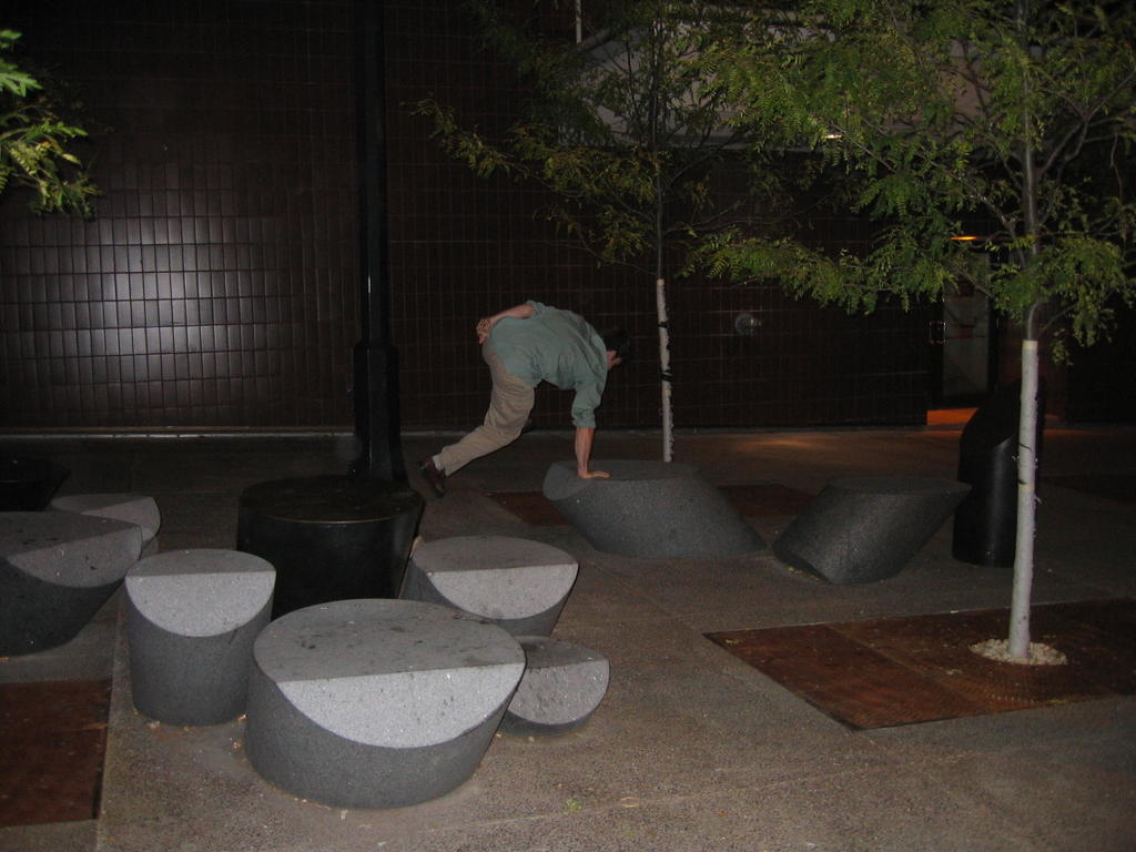
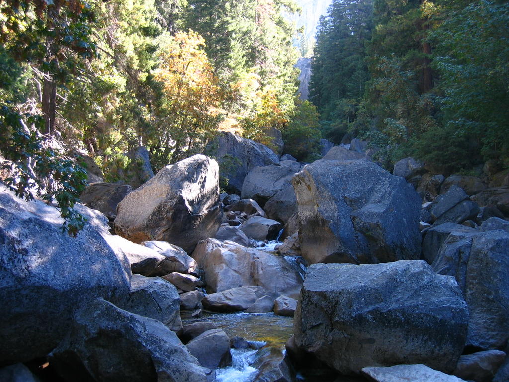
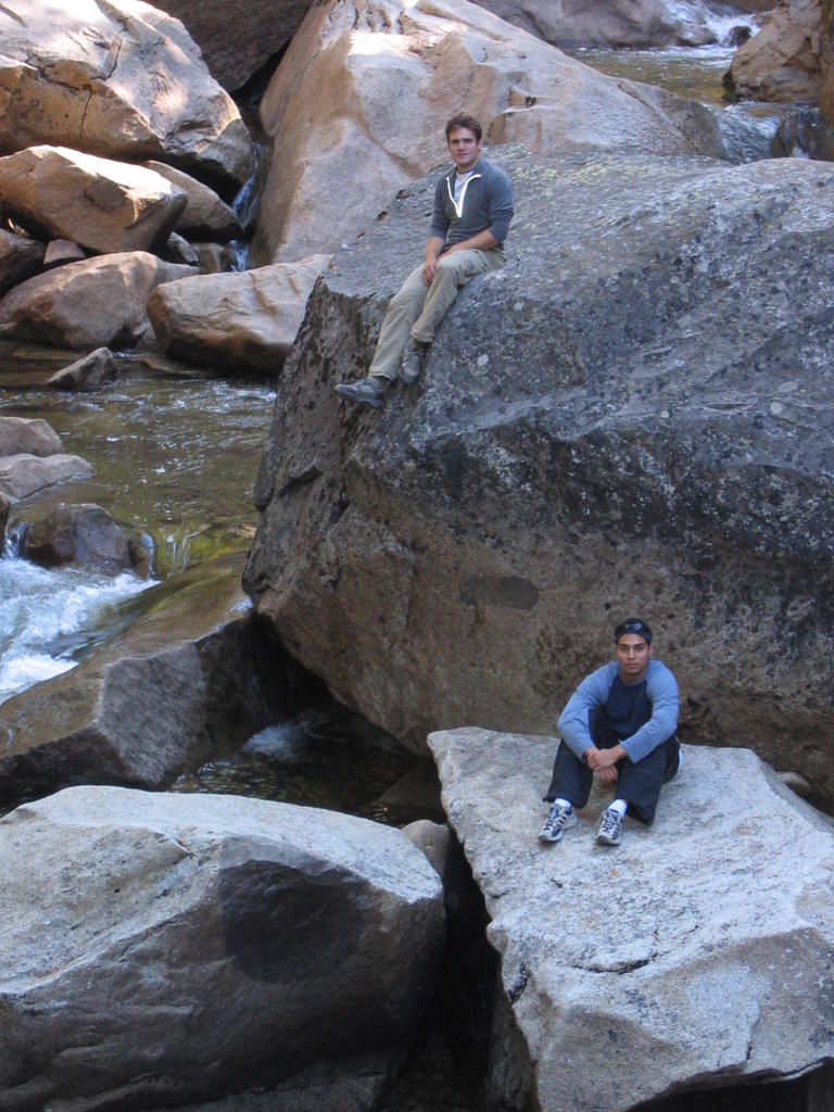
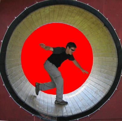
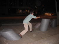
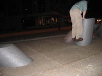


The back course

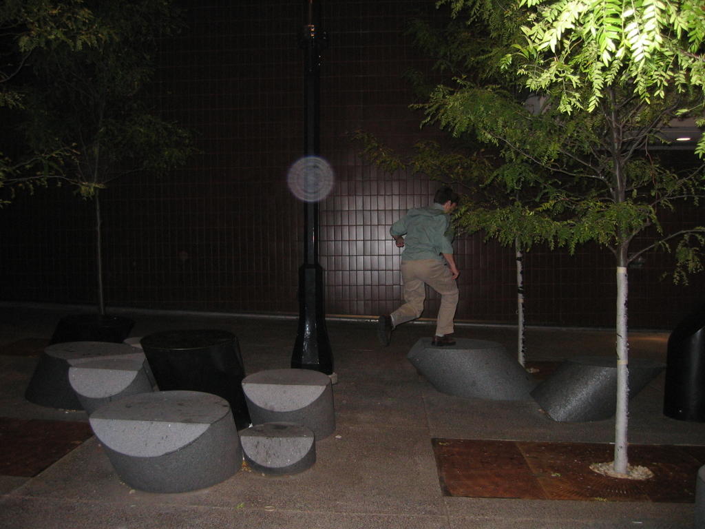
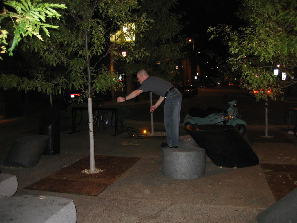
We started on the back course, which is in my opinion, slightly easier, but more technical, and more fun. After clearing that, we attempted a couple of alternate routes involving trees, and lampposts; they didn’t really improve on time, but did mix it up a little more. From there, we moved onto the front course, which is harder, with some tougher moves, but shorter. There was one move in particular, that took me forever to get. At one point we were even experimenting with a rock to tree to metal newspaper box to rock sequence, before we finally figured out the proper move, which was quite difficult. After clearing this board, we then worked on clearing it backwards, which provided completely new challenges.
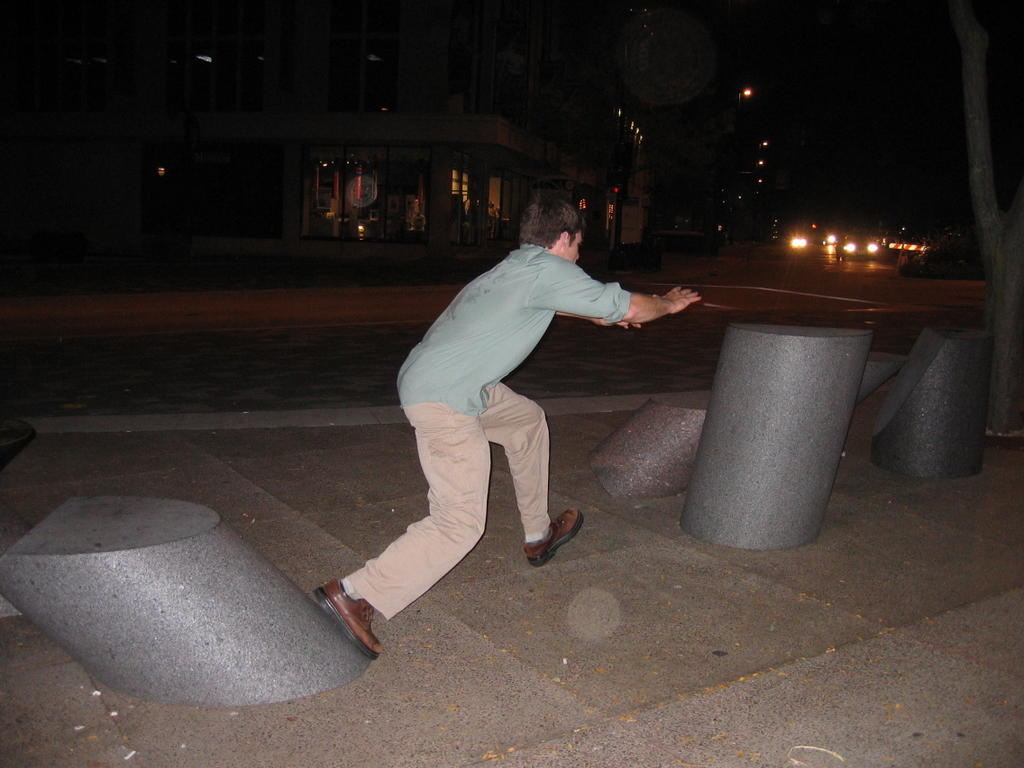
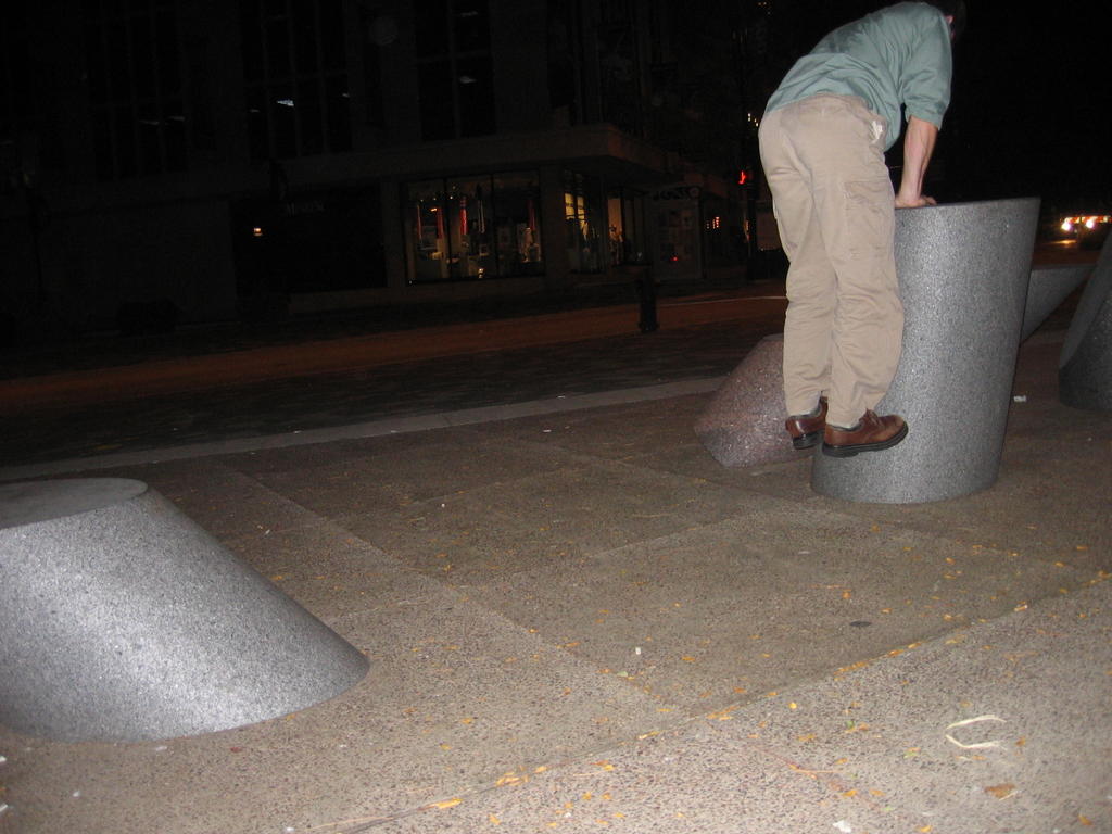
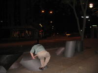
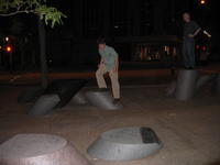
On the front course

All in all, this was a great time; we probably spent a good 1 ½ hours playing around, and that was on the way TO the bar. Who knows what kind of fun could be experienced on the way BACK from the bars.

I would highly recommend this to anyone who happens to find themselves in Madison. The two boards are located at the intersections of Carroll, Mifflin, State streets; right by capital square. If any police try to prevent you from jumping on the “art,” ignore them, they obviously don’t know the true splendor of Lava Rock Rock Revolution. I won't post any of the solutions, but trust me, both courses can be solved.

Thursday, October 06, 2005

bunny hop

An interesting thing happened Monday while biking home from dropping the rent off. I suddenly came across a deep pothole traveling at hi speeds. (I was going at high speed, not the pothole.) I must not have been paying attention, because usually I would see these things in advance, and swerve out of the way. Not having time to take evasive action, I popped the front tire up, to minimize the jolting and potential damage. That’s when the strange thing happened. Instead of just my front tire coming up, my rear wheel also followed, allowing me to clear the menacing hole with my back tire just barely glancing off the opposite edge. I had just inadvertently done my first bunny hop.

Despite having some mountain biking experience, this was always one thing I could never get the hang of, despite practicing. Granted, I think the road bike makes it a little easier, being lighter and having drop bars whose shape provide significantly more torque to lift the rear. Regardless, I was very excited and starting practicing, realizing that I could easily jump the rear wheel at will. I now see how the fix speed riders are able to do those skid stops. Neither of my tires touched a manhole on the rest of the way home, until I suddenly got a rear wheel flat. Looked like a pinch, two large pin holes a ½ cm apart, no sharp objects in the tire, most likely caused by jumping with an improperly inflated tube. The next day though, coming back from work, I flawlessly jumped over a bunch of garbage in the bike lane without even thinking about it, and that was with a laptop and panniers weighing down the back.

As visions of parallel curb hops, and skid stops dance through my head………

Monday, October 03, 2005

Yosemite - Half Dome

Summit Elevation: 8800'
Trail distance: ~17+ round trip (varies by where you park, shuttle bus ect.)
elevation gain: 4800'

I took my first trip to Yosemite two weekends ago to hike the legendary Half Dome summit trail. I’ve heard this referred to as one of the best day hikes in the country. I don’t think I’d go as far as calling it that, but it does contain two features that like to see in a great hard hike; height and distance. Being at least 8 miles each way, with a total elevation gain of 4800’, the trail was somewhat of a challenge and a lot of fun. The feature that makes this trek most noteworthy; however; is the very last section of the trail that involves using ¾ in steel cables to haul yourself up a 49 degree incline.


Classic view of Half Dome where you can see the 4000ft cliff face formed when half of the mountain fell off thousands of years ago. This sight can only be seen by climbing up a a trail on the opposite side of valley from where we were, so I had to steal this pic from another website: http://www.raingod.com/angus/Gallery/Photos/NorthAmerica/USA/California/YosemiteHalfDome.html

We left Friday evening so we could get on the trail earlier in the morning, and also to cut down on Saturday drive time, since it’s a 3+ hour drive each way. This also meant that we arrived late enough that the park gates were left unattended, saving us the $20 entrance fee. As expected, the camp sites were full, so we grabbed our gear and hiked down a trail, that according to my map, went passed park boundaries and back into the National Forest. (This is important because you can generally camp anywhere you want in a National Forest , but rangers frown up, to say the least, people disperse camping inside the National Parks.)


(1)Camp in the forest (2)Javier walking down the road to the trailhead (3)Stream (duh)

We got on the Half Dome trail later than I had hoped the next morning, hitting the trail head some time after 9:00. This meant was that we’d have to deal with a lot more people. Hundreds and hundreds of people hike the trail on a daily basis.

The hike started with a very gradual incline, shortly leading us to a bridge with a nice picture opportunity.


(1) Javier on the bridge - Yes, there were three of us on the trip, two were named javier. (2) Rocks in the water (3) Javier and I on the rocks. Ok, I guess these pictures don't need much description

From there, the trail started the moderate switchbacks leading up the valley. A few miles later we hit a fork in the trail, where you have the option of either heading down to go past Nevada falls (which would then entail needing to climb up again), or to continue up, and cross over the source of the falls. We chose the recommended route that continued up. This part of the trail is known as “Mist Trail”, because the cliff above you is part of the watershed area that creates the falls. We were there during the dry part of the season though, so despite there being some dripping water, the trail was relatively dry compared to what it can be.


Nevada Falls and the Mist Trail


Shortly afterwards we came to the bridge that crossed over the stream pouring over the mountain to form Nevada Falls. I was rather impressed with the overall setup. You could tell that the entire area was maintained rather regularly, and designed to accommodate a large number of people, of which there were a lot of hanging about. Despite this, though, the park had managed keep the area looking very natural, and any improvements made by them were very unobtrusive to the surroundings.


Top of Nevada Falls

After leaving the crossing, the switchbacks picked up a little more pitch, which lead to requests from the others to take breaks. Apparently some people like to breaks while hiking; who would have guessed. This eventually led to us taking a lunch break, which was understandable since it was already well past noon. The extra calories from lunch gave me a big sugar push, and I ran the final mile or so up the regular part of the trail, leaving the valley, and hitting the actual dome of the mountain. This gave a good twenty minutes or so to wait up for the others. While I was waiting, I saw two teenage girls come down the mountain from the dome. As they started down the trail, one of them actually whipped out an old style compact, and started reapplying base to her face. Unfortunately, I couldn’t get the camera out in time.


Approaching the dome, and starting up it

The first part of the last part of the trail consists of very steep switch backs which could best be described as stairs carved, jack hammered, and built into the mountain side. At some points, you are actually just walking up a rather smooth slope of granite. I was rather impressed by older people who were tackling this task. Then, we came to the infamous cables.


The upper dome, and the infamous cables


The cables were much steeper than I expected. I’m used to popular trails like this being built to accommodate the lowest common denominator. I figured there’d be all sorts of warnings, but when I’d get there, the slope would be shallow enough to walk up if you were competent, and that the cables would be there just for assistance. Uh uh. There were two cables, set up about 3 feet apart, held up by poles drilled into the rock. This formed a channel to walk up, with a hand on each cable. Every ten feet or so, a wooden two by for was fixed to the ground, to allow something firm to place your feet on. The problem, though, is that there are people trying to go down, and up at the same time, which drastically slows down the climbing process. As a result, the line was moving pretty slow. (Yeah, there’s a line) We followed the handful of people who were going up the outside of the cables ladder, instead of the inside. This allowed us to pass everyone stuck in the line. This was a lot more dangerous, though. If you’d slip, and loose your grip on the cable, you’d most like tumble down the dome, and off the side, which would be 4000’ drop.


"The diving board" as it is called, protrudes over the edge. There were so many people, you had to stand in line to get your picture on it


On the summit

After hanging out on top for a while, we took some pictures, and headed down, just making it before dark. We stopped in “””” for really good pizza on the way back, and made it back to Sacramento around midnight.

Views of Yosemite Valley from the summit of Half Dome

Quote of the trip:
(And this was said in all honesty during a conversation.)

Javier Pasillas: “What’s that called, those things that people have?
Derek: “Ethics?”
Javier: “Yeah, that’s it. Ethics.”